|
Modern Routes Ladakh
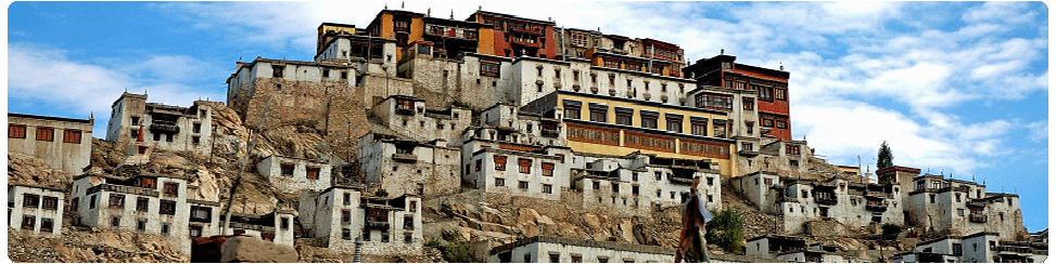
Ladakh the northern most province of the state,
is situated between 30 degree to 36 degree east
latitude and 76 degree to 79 degree north
longitude. The region of Ladakh spread over to
an area of 96,701 Sq.Kms and comprising a
population of 2 Lakhs habitants and consists of
two districts,Leh and Kargil. The region of
Ladakh normally remains land locked between
November to June every year as Srinagar-Ladakh
and Ladakh-Monali highways,which connect Ladakh
with the other parts of the country, remain
closed during this period because of snow and
rigorous winter.Ladakh is also the land of many
lakes and springs.
Climate
In winter the temp touches as low as minus 30
degree(Leh & Kargil) and minus 60 degree in
(Drass) subzero temp.prevails from December to
February throughout Ladakh, where as, zero
degree temp.'s experienced during rest of winter
months. This result in freezing of all
conceivable water resources. During summer the
maximum temp.increases from 20 degree C to 38
degree C in July and August. The relative
humidity is low and ranges from 31 to 64
percent.
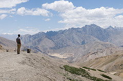
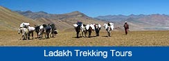
Trekking Routes
in Ladakh
The Pangong Lake Circuit
The beautiful high altitude Pangong Lake is also
another popular destination with trekkers. It is
a picturesque route that covers Shey and Thikse
with their interesting monasteries, before
turning off into the side valley of Chemrey. It
goes over the Chang - la , the pass over the
Ladakh range which despite it height is not too
difficult to tackle. At the base of the pass,
tangse has an ancient temple. The trek ends at
spangmik, which is the furthest point to which
foreigners are permitted - about 7 km along the
southern bank of the lake.
Kargil
Located in an ideal location within the centre
of the Himalayan region, Kargil is one
destination of Ladakh with tremendous potentials
for adventure activities. Kargil serves as an
important base for adventure tours in the heart
of Himalayas. It is also the take off station
for visitors to the heaven of exotic Himalayan
locales, Zanskar Valley. Tourists travelling
between Srinagar and Leh have to make a night
halt at Kargil before starting off the second
leg of their trekking journey.
The Korakoram Range
The range of mountains north of Ladakh, and thus
north of the Himalayas, has 10 peaks over 7,000m
including at 8,611m, the world's second highest
peak, Mt. Godwin Austen, also known as K2. It
stands in the Pakistani held part of Kashmir.
Because the mountains in the Karakoram rise from
a base altitude averaging close to 3,000m they
do not look as impressive as the Himalayas.
Trekkers should note that this region is outside
the permitted zone.
Nubra Valley
Along the eastern ridge of the Karakoram Range
in northern Ladakh is the Nubra valley
comprising of the upper Shayok and Nubra river
valleys. The trekking route to this area is
demanding and traverses the Kardung-la pass
along the ancient trade route from Leh to
Central Asia. It is the highest motorable road
in the world! The breathtaking view from the
pass surveys an entire length of the Indus
valley in the south and a magnificent panorama
of snow clad peaks. The route follows the valley
past attractive villages to Deskit, the largest
village in the valley. Onwards to Hundar down
the Shayok valley, the trail wanders past
rolling sand dunes. There is a small population
of double humped Bactrian camels here and
visitors can avail of a marvelous moonlight
camel safari on the dunes.
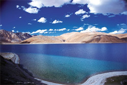
The Tso Moriri Lake
The Leh-Manali road goes through the upland
desert plateau of Rupshu inhabited only by the
nomadic chang-pa herdsmen and their flocks of
Pashmina goats. Its bare rolling hills
interspersed with dusty valleys are the setting
for the spectacular Tso Moriri Lake and other
lakes in the area.
One trek wends its way to Korzok located just 5
km along the lake's 23 km length. This route
takes off along the Leh-Manali road over the
Taglang -la, proceeds to the twin lakes of
Startsapuk Tso (a fresh water lake) and Tso-Kar
(a salt water lake) and then on to Korzok
Zangskar Region
Lamayuru-Padum
This is a rigorous grade 10 days trek route
crossing the highest pass of 5,100 meters.
Passing through world's highest mountains this
is indeed a very good trek.
Padum-Darsha
This is also a 10 days trek leaving Zangskar
region for Himachal Pradesh.
Hemis-Padum
It is a 12 days trek with over 100 river
crossings on the way. It is a tough trek that is
only possible when the water level goes down
(from last week of August till September end).
Changthang / Rupsho valley region
Rumtse-Tsomoriri This is an 8 days trek crossing
three 5000+ meters passes on the way leading to
the beautiful plains of Rupsho and the beautiful
high altitude lake Tsomoriri at 4200 meters.
Lato-Tsomoriri
This is a 15 days trek leading to Rupsho Plains
via Markha Valley and is a high altitude trek
with almost crossing a pass everyday. The
highest pass on the way is about 5300 meters
high (Zalung Karpo La).
Nubra valley region
Saboo-Khalsar
This a 5-6 days trek crossing Ladakh Range from
Central Ladakh for Nubra Valley in the north.
Spectacular views of Karakoram Range on the way
and crossing Khardungla (highest motorable road)
on the way back are its special features.
Saboo-Phyang
This is a 14 days trek and is in continuation of
the above trek from Nubra Valley back to Indus
Valley at Phyang crossing Lasermo Pass (5200
meters).
|